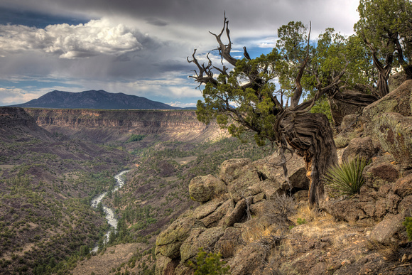
Wild Rivers view
The Rio Grande flows through a sizeable gorge for the first 78 miles of its journey through New Mexico, from the Colorado border as far as Velarde, southwest of Taos, where the cliffs recede. The first 50 miles is a National Wild and Scenic River, the first area in the US to be so designated (in 1968), and cuts through remote, volcanic land - a flat lava plateau dotted with the black cones of long extinct volcanoes, generally deserted and undeveloped. Most is accessible only by unpaved tracks that run to or along the canyon rims, apart from the deepest part of the gorge west of Questa, which is part of the BLM-managed Wild Rivers Recreation Area, where a paved road runs alongside the Rio Grande for 7 miles and ends at a narrow promontory above the junction with the smaller Red River. This flows westwards from the Sangre de Cristo Mountains and its lower end is also contained within a deep canyon, joining the Rio Grande 800 feet below the plateau.