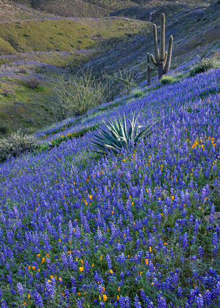
Silver King Hills-133
High on the side of King's Crown peak the ground is carpeted with blue Coulter's Lupine and a sprinkling of gold Mexican poppie's surrounding a Century plant, Ocotillo and Saguaro's. Kings Crown Peak is a mountain summit in Pinal County in the state of Arizona (AZ). Kings Crown Peak climbs to 5,249 feet (1,599.90 meters) above sea level. Kings Crown Peak is located at latitude - longitude coordinates (also called lat - long coordinates or GPS coordinates) of N 33.332 and W -111.07123.