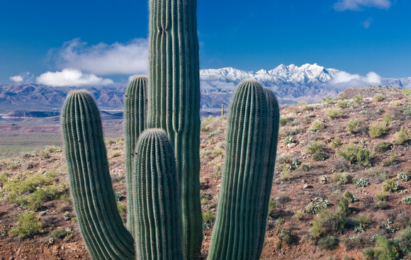
Sierra Anchas Saguaro & Four Peaks
Snow Capped Four Peaks from the The Sierra Ancha (“broad range” in Spanish) is a mountain range in Gila County, in central Arizona. It lies between Roosevelt Lake to the south, the Tonto Basin to the west, Cherry Creek to the east, and Pleasant Valley to the north. The range is one of several, including the Bradshaw Mountains, Mingus Mountain of the Black Hills, and the Mazatzal Mountains, which form a transitional zone between the lowland deserts of southern Arizona and the Colorado Plateau of northeastern Arizona. The highest point in the range is Aztec Peak, at an elevation of 2345 m (7694 ft).
The Sierra Ancha is penetrated by few improved roads, and the range is cut by numerous deep, spectacular canyons, particularly on its eastern flank. Little agricultural, commercial, or residential development has taken place, though in the past asbestos mining was carried out at a mine between Asbestos and Zimmerman Points. Cattle ranching is still practiced in the area. Nearby communities include Roosevelt, Tonto Basin, Punkin Center, and Young, Arizona. The Sierra Ancha lies completely within Arizona's Tonto National Forest.