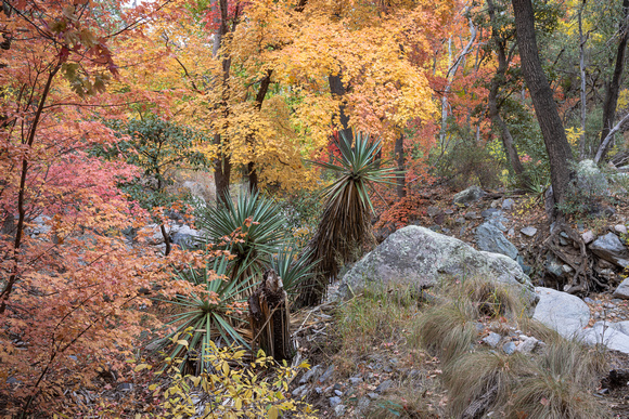
Miller Canyon Trail. The 3.5-mile route begins by circumventing a slice of private property before heading out on a former mining road. Within a few yards from the trailhead, views of the San Pedro Valley and the Mule Mountains around Bisbee peek out from a fringe of oak trees and high desert scrub and cactus. This little tease of vistas is the last glimpse offered before the route enters the Miller Peak Wilderness area and slips into a riparian zone at the head of the canyon.
Shaded by gigantic sycamore and walnut trees, the green oasis is fed by an intermittent stream that flows from springs and runoff originating high in the hills above. The path gradually leaves the high-desert vegetation zone and moves into a wetter, canyon-bound corridor of big-tooth maples and soaring canopies of arching oaks.