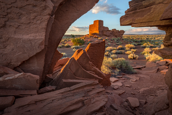
Wukoki Pueblo Sunrise
Located in the Wupatki National Monument, the Wukoki Pueblo is a classic example of early pueblo construction. The earliest known observation of the ruins was made in 1851 during the U.S. Army exploration of Brevet Captain Lorenzo Sitgreaves. Guided by the mountain man, Antoine Leroux, the Sitgreaves party had the assignment of exploring the Zuni and Colorado River valleys. (See Anthropology Laboratories of Northern Arizona University (NAU), "History of Archaeological Studies at Wupatki")
Contrary to many of the ruins in the American Southwest, Wukoki and Wupatki, are prominently located on hills overlooking the vast stretches of the Colorado Plateau. Wukoki in particular appears to have been strategically located for observation purposes. If there was an alert watcher on top of the towers, he or she could have seen someone coming many miles away. The site easily reminds me of the pictures I have seen of European castles. The sites for the dwellings was certainly not located for close proximity to running water, the only significant stream in the area, the Little Colorado River, is about five miles from the site of the pueblo. In this map, Wukoki is in the center of the map.The site marked "B" is the Wupatki ruin. The white line running on the right of the map is the Little Colorado River.