Multnomah Falls
Multnomah Falls is a waterfall on the Oregon side of the Columbia River Gorge, located east of Troutdale, between Corbett and Dodson, along the Historic Columbia River Highway. The falls drops in two major steps, split into an upper falls of 542 feet (165 m) and a lower falls of 69 feet (21 m), with a gradual 9 foot (3 m) drop in elevation between the two, so the total height of the waterfall is conventionally given as 620 feet (189 m). Multnomah Falls is the tallest waterfall in the State of Oregon.
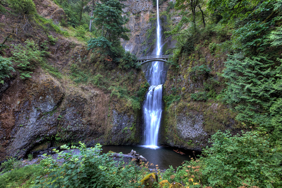
The Multnomah Creek Bridge on the Historic Columbia River Highway.
Colorized picture of the waterfall before the footbridge was addedUnderground springs from Larch Mountain are the year-round source of water for the waterfall, augmented by spring runoff from the mountain's snowpack and rainwater during the other seasons.
A foot trail leads to Benson Footbridge, a 45-foot (14 m)-long footbridge that allows visitors to cross 105 feet (32 m) above the lower cascade. The trail continues to a platform at the top of the upper falls, the Larch Mountain Lookout, where visitors get a bird's-eye view of the Columbia Gorge and also of "Little Multnomah", a small cascade slightly upstream from the "upper" falls, which is not visible from ground level. The footbridge is named after Simon Benson, who had the bridge built in 1914.