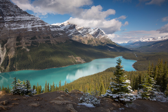
Peyto Lake After the Snow
Peyto Lake (/ˈpiːtoʊ/ PEE-toh) is a glacier-fed lake in Banff National Park in the Canadian Rockies. The lake itself is easily accessed from the Icefields Parkway. It was named for Bill Peyto, an early trail guide and trapper in the Banff area.[1]
The lake is formed in a valley of the Waputik Range, between Caldron Peak, Peyto Peak and Mount Jimmy Simpson, at an elevation of 1,860 m (6,100 ft).[citation needed]
During the summer, significant amounts of glacial rock flour flow into the lake, and these suspended rock particles give the lake a bright, turquoise colour. Because of its bright colour, photos of the lake often appear in illustrated books, and the area around the lake is a popular sightseeing spot for tourists. The lake is best seen from Bow Summit, the highest point on the Icefields Parkway