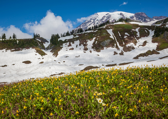
Paradise Valley Snow Flowers
Mount Rainier National Park is a United States National Park located in southeast Pierce County and northeast Lewis County in Washington state.[1] It was established on 2 March 1899, the fifth national park in the United States. The park contains 368 square miles (950 km2) including all of Mount Rainier, a 14,411-foot (4,392 m) stratovolcano.[2] The mountain rises abruptly from the surrounding land with elevations in the park ranging from 1,600 feet (490 m) to over 14,000 feet (4,300 m). The highest point in the Cascade Range, around it are valleys, waterfalls, subalpine wildflower meadows, old growth forest and more than 26 glaciers. The volcano is often shrouded in clouds that dump enormous amounts of rain and snow on the peak every year and hide it from the crowds that head to the park on weekends.
Mount Rainier is circled by the Wonderland Trail and is covered by several glaciers and snowfields totaling some 35 square miles (91 km2). Carbon Glacier is the largest glacier by volume in the continental United States, while Emmons Glacier is the largest glacier by area. About 1.3 million people visit Mount Rainier National Park each year. Mount Rainier is a popular peak for mountain climbing with some 10,000 attempts per year with approximately 25% making it to the summit.
The park contains outstanding subalpine meadows and 91,000 acres (370 km2) of old growth forests.